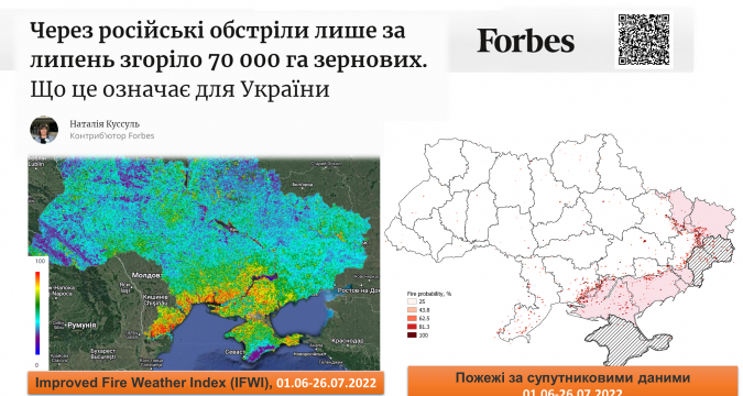
In Forbes news, the results of the research of the employees of the of the Space Research Institute of the National Academy of Sciences of Ukraine and the SSA of Ukraine together with the specialists of the Department of Mathematical Modeling and Data Analysis of the Educational and Research Institute of Physics and Technology NTUU “Igor Sikorsky Kyiv Polytechnic Institute” , who determined the burned areas of Ukraine based on satellite data, were published.
Only in July 2022, about 70,000 hectares of grain crops were destroyed in the combat zone along the front line.
“Unlike the previous months of the war, it was in July that the ready-made harvest caught fire incredibly quickly from the impact of rocket fragments or artillery fire,” says Prof. Natalia Kussul, head of the Department of Mathematical Modeling and Data Analysis.
Read more about the analysis of grain losses, as well as about fires in other natural ecosystems, at the link.
The evaluation technology for monitoring burned areas was developed and tested within the framework of the project of the National Research Fund of Ukraine “Information technology for assessing fire danger and monitoring fires in natural ecosystems based on satellite data.” It is thanks to this project that we have the opportunity to quickly monitor the losses from which the economy of the state, and not only Ukraine, suffers.

