
On August 21–22, 2026, the Third International Virtual Conference on Ukraine—focused on the country’s reconstruction and future development—was held online, organized by Linköping University.
The conference brought together researchers and practitioners from various countries to discuss issues regarding Ukraine’s post-war recovery, socio-economic transformation, and long-term national development.
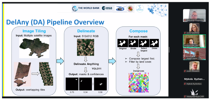
Two research studies involving scientists of our Department and they were presented at the conference by PhD students of Prof. Nataliia Kussul: Sofiia Drozd and Yevhenii Salii. Yevhenii Salii also served as the chair of the session titled “Information technology and knowledge-based economic development.”
The presented works were:
1. The study “AI-Enabled Forest Condition Monitoring in Ukraine for Environmental Recovery and Governance” (authors: Nataliia Kussul, Andrii Shelestov, Sofiia Drozd, Sergii Skakun, Klaus W. Deininger) focuses on the use of AI and satellite data to classify forest damage types, assess damage, and identify areas where natural vegetation recovery is already underway following damage—factors crucial for ecosystem assessment and recovery planning.
2. The study “Automated Land Parcel Identification System (LPIS) Parcel Segmentation in Ukraine: A Scalable, AI-Driven Framework Using Open Satellite Data” (authors: Nataliia Kussul, Klaus Deininger, Yevhenii Salii, Mykola Lavreniuk, Andrii Shelestov, Zoltan Szantoi) focuses on developing an approach for the automated segmentation of land parcels using open satellite data to implement the Land Parcel Identification System (LPIS) in Ukraine and align it with relevant European Union standards. Presenting this research at an international conference demonstrates how modern methods of artificial intelligence, satellite monitoring, and geospatial data analysis can support decision-making in the areas of environmental restoration, natural resource management, and Ukraine’s integration into the European space.
Together, these studies demonstrate how modern AI technologies and satellite monitoring can facilitate the harmonization of Ukraine’s forest and land resource management systems with European standards, enhance land-use transparency, and provide a reliable information foundation for Ukraine’s recovery.